Mapping freight transport

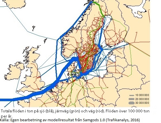
How well is Swedish freight transport working in urban and rural areas? What are Sweden's most important freight corridors, and what types of traffic are using them? Transport Analysis is addressing these issues in a new freight transport project.
Commission in Swedish
- Rapport 2016_9 Godstransportflöden - analys av statistikunderlag Sverige 2012-2014.pdf
- PM 2016_3 Godstransportflöden - Statistikunderlag med varugruppsindelning.pdf
- PM 2016_4 Svenska transportflöden - modellberäkningar.pdf
- PM 2016_5 Urbana godstransporter.pdf
- PM 2016:6 Freight transport - a business environment analysis
- PM 2016:9 Accessibility to terminals in Västra Götaland County – a pilot study
- PM 2015_16 Skogens transporter - en trafikslagsövergripande kartläggning.pdf
- PM 2015:17 Dagligvaruhandelns distribution - en kartläggning.pdf
- PM 2016:10 Train paths, freight and congestion on the tracks
- PM 2016_11 Statistik och kunskapsunderlag.pdf
- WSP Foerutsaettningar för godstransporter - en intressentundersoekning.pdf
- Rapport Sweco Potentialen i ny teknik i godssystemet.pdf
- Uppdrag att redovisa ett samlat kunskapsunderlag och en nulägesanalys om transporter av gods 2015-06-25.pdf
The project seeks to create a knowledge base for the Government regarding the status of freight transport in Sweden. This applies to all modes of freight traffic (i.e., lorries, trains, ships, and aircraft) throughout the country. Freight transport will be mapped in urban areas, small and medium-sized towns, and towns in sparsely populated and rural areas.
"The project consists largely of interpreting and analysing existing data in order to compile it into a single whole. But it includes some entirely new analyses as well", says Transport Analysis Project Manager Krister Sandberg.
The results will be published on 1 April 2016 in a single report addressing the following questions:
- How can city logistics, such as grocery stores, become more efficient?
- How might technological advances and new, innovative solutions impact freight transport?
- What changes in the outside world could affect future demand for freight transport in Sweden ?
- Is it feasible and efficient to increase our use of waterborne traffic on inland waterways such as lakes and of rail traffic for freight transport?
- Are there ways of reducing the environmental impact of freight transport?
The project will also follow up on shipping statistics and propose means of ensuring that these statistics can expand our knowledge of freight transport.
Transport Analysis will be working in cooperation with the Swedish Transport Administration, the Swedish Transport Agency, the Swedish Maritime Administration, and the Swedish Aviation Administration.
